The Italian Agency for Development Cooperation (AICS) announced on Thursday the launch of a geographic platform to support sustainable land and water management in Libya.
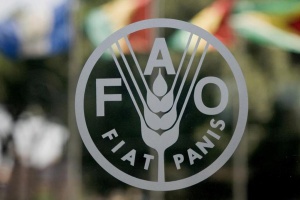
The platform will be run in collaboration with the Food and Agriculture Organization (FAO), the Ministry of Water Resources, the Ministry of Agriculture and Animal Wealth, the Libyan Center for Sustainable Development, and the Libyan Center for Remote Sensing and Space Science.
In a press release, AICS said the geospatial platform (MIRWAT-Libya) will serve as a tool for making informed decisions in agricultural development using advanced information and data.
It would also provide geospatial information to support water resource management in Libya and enable national partners to access vast spatial data to support sustainable water and crop production while considering available natural resources.
According to the agency, the program is a key result of the project aimed at monitoring, evaluating, and guiding water use in Libya's agricultural sector, funded by the Italian Ministry of Foreign Affairs and International Cooperation (MAECI) with a grant of 830,000 euros.
It emphasized that the innovative tool serves as a centre for digital data exchange and dialogue, highlighting the increasing importance of geospatial technology in modern agriculture.
Furthermore, the initiative provides comprehensive capabilities for accessing, storing, processing, and analyzing spatial data, which are essential for making informed decisions in agricultural development.
The (MIRWAT-Libya) system also includes datasets on crop types, cultivated field boundaries, hydrological basins, and soil classification, enabling stakeholders to access accurate information for making informed decisions, according to the same source.